


At the 2026 Stockholm World Water Week, global water experts convened to tackle a critical bottleneck in Africa’s climate resilience: the groundwater data gap. By shifting focus toward conjunctive water management and sustainable data collection, development practitioners are mapping a pathway to turn ambitious transboundary goals into incremental, life-saving gains.
Groundwater has the potential to advance Africa’s water security, climate resilience, and economic development. Yet, despite its critical importance, this hidden resource has historically been overlooked in favor of more visible surface water systems.
At the 2026 Stockholm World Water Week (SWWW), this paradox took center stage during the session titled, “Ambitious Aims, Incremental Gains: Enhancing Groundwater Data to Unblock Progress”. As Jonathan Lautze, Research Group Leader at the International Water Management Institute (IWMI), noted in his opening remarks, advancing groundwater in Africa is frequently framed as a data gap challenge. However, efforts to expand data collection often fall short of their ambitions, and the potential of existing data remains largely unharnessed.
Addressing this gap is a key focus for both the Global Environment Facility (GEF), through its upcoming GEF-9 investments, and the African Ministers’ Council on Water (AMCOW) through its Africa Water Vision 2063 initiative. Indeed, Nelson Gomonda, Acting Executive Secretary at AMCOW, and Konstantina Toli, GEF’s IW:LEARN Project Coordinator, both emphasised the importance of robust data to unlock groundwater’s socio-economic potential and drive the cooperative, sustainable management of shared transboundary freshwater systems.
The SWWW session, reviewing three large-scale GEF projects, sought to address three core outcomes:
- Identifying ways groundwater data can better inform decisions to support people,
- Understanding how to collect data in a practically sustainable way,
- Generating concrete recommendations for future GEF-9 investments.
To unblock progress and achieve these outcomes, the international development community must shift from managing resources in silos and fully embrace conjunctive water management – an approach that coordinates surface water, groundwater, and other components of the water cycle as a single resource.
The hidden connection: Surface and groundwater synergy
At a broad scale, the jury remains out on the degree to which transboundary governance frameworks translate into practical decisions. However, understanding the deep physical connections between water sources is the first step toward effective governance. When these interconnected resources are managed separately, communities face poor planning, increased vulnerability to droughts, and heightened regional tensions.
Soumaya Mouhli, a Water Expert at the Sahara and Sahel Observatory (OSS), provided a compelling example of this connectivity during her presentation on the region’s aquifers systems, including the Senegalo-Mauritanian and Iullemeden-Taoudeni/Tanezrouft Aquifer Systems. Through rigorous hydrogeological modelling, Mouhli’s team quantified a sizeable, ongoing exchange of water between the Niger River and the underlying transboundary aquifer.
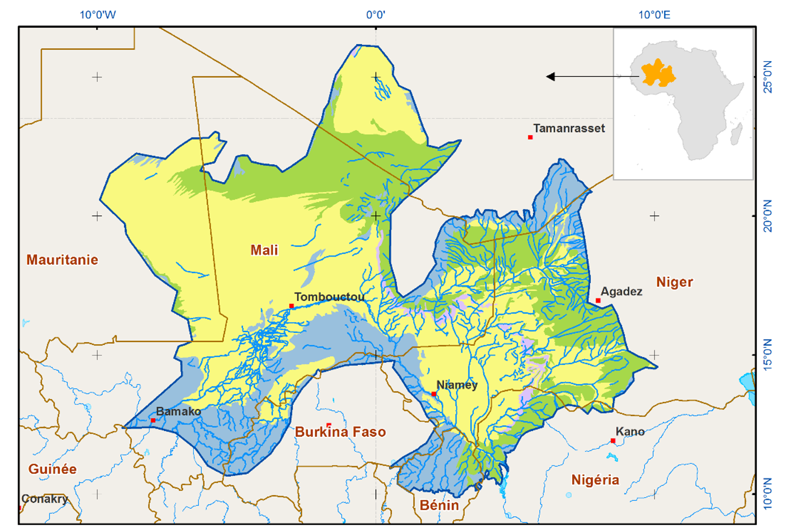
The Iullemeden-Taoudeni/Tanezrouft Aquifer System (OSS).
Mouhli’s modelling demonstrated that the Niger River loses approximately 35 million cubic meters of water per year to recharge the aquifer, while the aquifer simultaneously pushes around 650 million cubic meters per year back into the river network as baseflow.
These findings proved definitively that surface and groundwater cannot be managed in isolation. Decisions affecting river flow will alter aquifer recharge, while excessive groundwater pumping will directly drain river ecosystems and impact downstream communities. Establishing shared, transboundary data governance frameworks is essential to managing this delicate balance.
Data-driven action: Managed aquifer recharge (MAR)
While regional governance provides the framework, localized monitoring is key to generating aquifer knowledge that informs practical decisions. Maha Abdelrahim, Groundwater Project Technical Lead at the Nile Basin Initiative (NBI), detailed how her team is packaging monitoring networks with concrete interventions like managed aquifer recharge (MAR).
MAR interventions strategically use surface water – including from monsoons and floods – to replenish depleted groundwater reserves, offering a vital buffer against climate shocks. However, MAR infrastructure is capital-intensive, making accurate preliminary data essential to avoid wasted investments.
During the implementation of pilot MAR projects in Kenya and Rwanda, NBI initiated their site selections using standard reconnaissance surveys. However, follow-up geophysical investigations (specifically resistivity surveys) revealed that the subsurface conditions at a targeted dam site in Kenya were not suitable for the original engineering plan. This ground-truthed data allowed engineers to rapidly alter the design and methodology of the MAR intervention before construction began.
By investing in rigorous geophysical data upfront, decision-makers avoided costly infrastructure failures and successfully adapted the water supply system to meet the community’s needs. To support these ongoing decisions, NBI operates a robust conjunctive monitoring network that blends ground stations with Earth observation data to produce seasonal hydrological outlooks and advisory bulletins.
Mapping groundwater risks and opportunities at scale
For development practitioners looking to allocate limited resources effectively, knowing where to invest is crucial. Dor Fridman, a researcher at the International Institute for Applied Systems Analysis (IIASA), introduced a tool designed to support strategic assessments at national and continental levels: the Groundwater Risks and Opportunities Atlas for Africa.
Currently under development as part of the Groundwater for aDvancing Resilience in Africa (G4DR) project, the Atlas maps groundwater potential directly against key human outcomes like safe drinking water and smallholder irrigation capacity. It systematically overlays these opportunities with potential risks, allowing users to explore development barriers when physical water potential intersects with contamination risks or weak local governance. For instance, country-level screening using the Atlas quickly identified that over five percent of the rural population in Tanzania resides in zones with strong groundwater provisional opportunities for domestic supply.
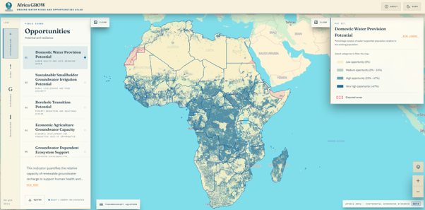
Dashboard view of the beta version of the Africa GROW Atlas (G4DR)
Sustaining the gains: Recommendations for the future
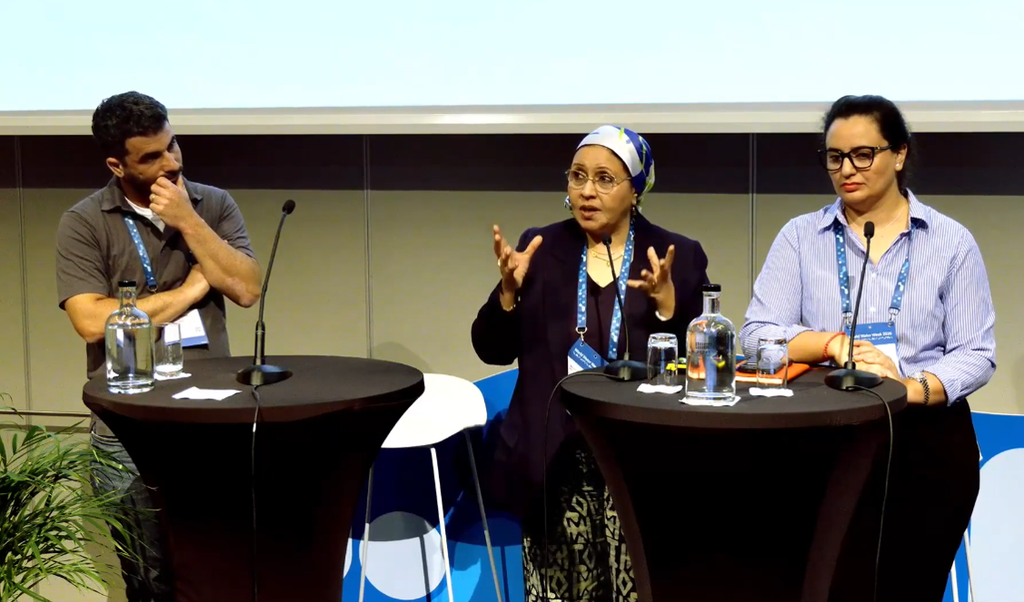
The final objective of the SWWW session was to generate concrete recommendations for future projects oriented toward groundwater, particularly for the upcoming GEF-9 funding cycle. During a panel discussion moderated by Callist Tindimugaya (Director at Uganda’s Ministry of Water and Environment), experts debated the viability of different approaches to data collection.
The panel identified several key lessons on what the international development community should build on, drop, and do differently moving forward:
- What to build on: The sector must continue to build on participatory approaches and capacity enhancement. Furthermore, establishing permanent regional research units (such as within the NBI) is essential to preserve institutional memory after temporary projects end.
- What to drop: The panel warned against investing in highly expensive, capital-intensive monitoring infrastructure if national institutions lack the resources to maintain it. Furthermore, treating groundwater data collection as merely a technical exercise must be dropped; without political trust and community buy-in, data projects will not succeed.
- What to do differently: A critical shift is required from focusing on data availability to data accessibility. While massive amounts of data are generated globally, it remains fragmented and inaccessible to those who need it most. Future projects must prioritize robust data-sharing protocols and interoperable platforms.
Groundwater resilience depends on reliable, shared information. By advancing conjunctive water management and committing to practically sustainable data collection, the ambitious aims of transboundary cooperation can be realised with incremental, unblocked progress for communities across Africa.


